
Land Planning Steps That Support Better Project Approvals
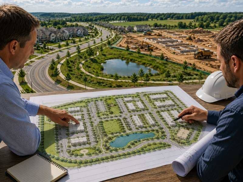
Land planning is the work of deciding how to arrange everything on a piece of property before construction begins. It sets where the buildings, roads, utilities and open space will go, and how they all fit together. A smart plan makes a project safer, easier to approve and better to use for years to come.
Start by Studying the Land
Every good plan starts with a close look at the property and what surrounds it. Planners study the slopes, the soil and the natural features that decide what can go where. A steep hillside might be wrong for a parking lot but perfect for open space. Wet ground or a rock ledge can rule out a building in one corner and push it to another.
What sits next door matters just as much. The roads that touch the property, the buildings nearby and the way people already move through the area all shape a smart layout. A plan that ignores its neighbors tends to create traffic messes and awkward corners. Reading all of this early lets the planner work with the land instead of against it.
Lay Out Roads, Utilities and Open Space
A site is more than its buildings, and a plan has to make room for everything else. Roads need to reach every lot and connect cleanly to the streets outside the property. Water lines, sewer lines and storm drains all need their own paths, usually tucked under roads or along the edges of lots. Get these routes right on paper, and the whole site works. Get them wrong, and pipes cross where they shouldn’t and roads dead-end in bad spots.
Open space deserves a real place in the plan too, not just the leftover scraps. Parks, buffers and green areas make a development safer and more pleasant, and they give stormwater somewhere to go. A good planner sets aside room for these features from the start. Squeezing them in later almost never works as well.
Plan for Future Growth
Smart planning looks past opening day and thinks about the next twenty years. A road built to handle only today’s traffic will choke once the area fills in. Planners often size the main streets and utility lines for the growth they expect, so the system doesn’t need a costly rebuild later. They may leave stub roads and pipe connections ready for the next phase or the next project over.
This kind of foresight helps a whole area grow the right way. When new development lines up with the roads, water and sewer that serve it, neighborhoods and businesses can expand without gridlock or shortages. Many local governments even require proof that the roads and water capacity can keep up with the new demand before they approve it. A plan that builds in room to grow saves everyone from painful fixes down the road.
Prepare Plans for a Smooth Approval
Local reviewers judge a plan against a thick book of rules, and a plan that ignores them goes nowhere. Most towns build their rules around a long-range master plan, the big-picture vision that works like a constitution for how the area can grow. A project that lines up with that master plan and the zoning code has a clear path forward. One that fights it faces a slow, uphill battle or a flat no.
The good news is that a complete, conforming plan is hard to turn down. In many places, once a site plan meets every code standard, the reviewers have to approve it. That’s why careful land planning pays off at the counter. When the submittal answers the rules point by point and leaves no obvious gaps, the review moves quickly instead of dragging through rounds of questions.
Build a Site That Lasts
A good plan keeps paying off long after the ribbon-cutting. Roads laid out with clear sightlines and smart connections stay safer to drive for decades. A layout that sends water where it belongs floods less and needs fewer emergency repairs. These aren’t flashy wins, but they save real money and headaches year after year.
The best sites feel easy to live and work in without anyone noticing why. That ease comes from choices made early, like sensible lot sizes, room to maintain the systems and open space people actually use. Poor planning shows up as daily frustration, like bad traffic and soggy corners that never drain. Time spent on the plan up front is what separates a site that ages well from one that becomes a problem.
Frequently Asked Questions
What is land planning?
Land planning is the process of arranging a property before anyone builds on it. It decides where the roads, buildings, utilities and open space go, and how they connect. The goal is a layout that’s safe, useful and ready to win local approval.
Why is land planning important?
A weak layout haunts a project for its whole life, while a strong one prevents problems before they start. Good planning keeps traffic flowing, water draining and space used well. It also helps a project meet local rules and clear review. Skipping it usually means paying to fix avoidable mistakes.
When should land planning begin?
Right at the start, before the design gets detailed or the land even changes hands. Early planning shapes every choice that follows, including where the entrance sits and how the lots line up. Bring it in late, and you’re forced to work around decisions that are already locked in.
Who creates a land planning project?
A land planner or land use planner usually leads the work, often alongside a civil engineer. On bigger sites, a landscape architect and a surveyor add their skills to the team. The property owner and local officials also shape the plan through their goals and rules.
How does land planning help with project approvals?
Reviewers approve plans that follow the town’s master plan and zoning code, so planning around those rules from day one clears the biggest hurdle. A complete, conforming layout gives officials little reason to say no. That means fewer rounds of questions and a faster path to a yes.