
Flood Study Requests Extend Beyond Flood Zones
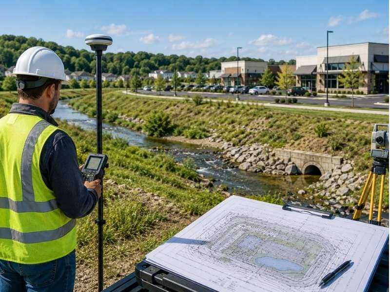
A flood study looks at how water moves across and around a site. For years, project teams ordered one mainly when a property sat in a mapped flood zone. That habit is changing. More agencies and engineers now ask for a flood study even when the site sits well outside those zones. The reason is simple. A map line doesn’t always match what the water actually does. Knowing the difference early can keep a project on schedule and out of trouble.
Why More Projects Need a Flood Study Today
Flood maps don’t tell the whole story. Many date back years and haven’t kept up with new roads, rooftops and parking lots. All that hard surface sends more water downhill, faster than the old maps assumed. A site that looked dry on paper can still take on water in a heavy storm.
Agencies have noticed. After years of costly flooding, many now ask for proof that a project won’t push water onto its neighbors. A flood study gives them that proof. It shows how water reaches the site, where it goes and how the design handles it.
This is why a mapped flood zone is no longer the only trigger. A site near a creek, at the bottom of a slope or downstream of new development may all draw the same request. The map is just one clue among several.
How Nearby Water Features Can Lead to a Flood Study
Water doesn’t care about property lines. A feature next door can put a site at risk, and a reviewer will want to know how. That is often what turns a routine project into one that needs a flood study.
A few site features raise the question fast:
- A creek or stream along or near the property.
- A ditch or channel that carries runoff during storms.
- A pond or wetland that rises after heavy rain.
- A low spot where water collects and lingers.
Each of these can send water toward a building or hold it on the site. An engineer studies how high the water can get and how often. That answer shapes where it is safe to build and how high the ground needs to sit. Without the study, the team is guessing.
Why Starting a Flood Study Early Can Save Time
A flood study works best near the start of a project, not the end. Its results can move buildings, raise pads and reshape the whole site plan. Find that out early, and the design grows around it. Find it out late, and the team has to tear the design apart and rebuild it.
Timing also affects approvals. Many agencies want the flood study in hand before they review the larger plan. A team that waits until the end can stall there, watching the schedule slip while the study runs.
Starting early costs a little upfront effort. It saves far more later. The study points out the real limits of the site before anyone commits to a layout that won’t work.
How a Flood Study Can Change Project Plans
The findings from a flood study can reshape a project in real ways. The biggest change is often where buildings can go. If part of the site can flood, the design moves structures to higher, safer ground.
Grading usually changes too. A study might call for raising a building pad above the expected flood level. It can also redirect how water flows across the site so it stays away from doors and foundations. These moves protect the people and property that will use the site later.
Drainage plans feel the effect as well. A study can show that the site needs more room to hold water, or a clearer path to send it away. None of these changes are busywork. Each one lowers the odds of flooded buildings down the road.
Why Good Site Data Is Important for a Flood Study
A flood study is only as good as the data behind it. Engineers need a close, accurate picture of the land and the water near it. Rough or old information leads to a study that misses the real risk.
The most useful data comes from a detailed survey. Engineers want tight ground elevations across the site and the area around it. They also want cross-sections of any nearby channel, which show how much water it can carry before it spills over. Together, these reveal how high a flood could climb.
The size of the upstream area matters too. The more land that drains toward a site, the more water can arrive at once. Solid data on all of this leads to a study a reviewer can trust, and a design built on facts instead of guesses.
Frequently Asked Questions
Why do some projects need a flood study?
A flood study shows how water could reach and affect a site during a storm. Agencies and engineers use it to make sure a project stays safe and doesn’t worsen flooding nearby. Projects near water or in changing areas are the most likely to need one.
Can a project need a flood study if it is outside a flood zone?
Yes. Flood maps can be old and may not reflect new development or current drainage. A site outside a mapped zone can still flood, so an agency may request a study to check the real risk.
What site features can trigger a flood study?
Streams, ditches, ponds, wetlands and low areas all raise the chance of one. Each can move water toward a site or hold it there after heavy rain. A reviewer will often ask for a study to see how that water behaves.
When should a flood study be done?
Early in the project is best. Doing it up front lets the results guide where buildings go and how the team grades the site. Waiting until the end can force major redesigns and hold up approval.
How can a flood study affect project design?
Its findings can shift building locations, raise pads and change drainage plans. The goal is to keep structures above the expected flood level and steer water away from them. These changes lower the risk of flooding for the finished site.